
![]()
Figure 2
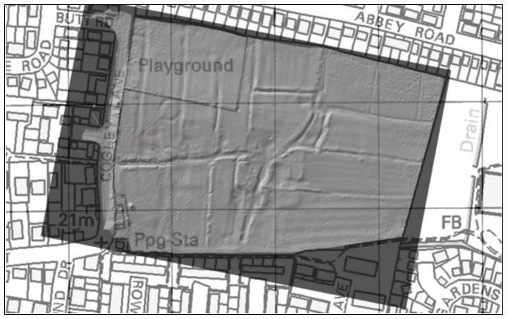
Grey-scale intensity view made from a topographical laser survey of Crow Close, overlaid on Ordnance Survey base mapping. Scale 1:2000. The survey was carried out by 3D Laser Mapping, of Bingham.
![]()
Grey-scale intensity view made from a topographical laser survey of Crow Close, overlaid on Ordnance Survey base mapping. Scale 1:2000. The survey was carried out by 3D Laser Mapping, of Bingham.